0
  • Adaptable Low Cost High Refresh Rate Strong Recognition Ability
  • Adaptable Low Cost High Refresh Rate Strong Recognition Ability
  • Adaptable Low Cost High Refresh Rate Strong Recognition Ability
  • Adaptable Low Cost High Refresh Rate Strong Recognition Ability
  • Adaptable Low Cost High Refresh Rate Strong Recognition Ability
  • Adaptable Low Cost High Refresh Rate Strong Recognition Ability
  • Adaptable Low Cost High Refresh Rate Strong Recognition Ability

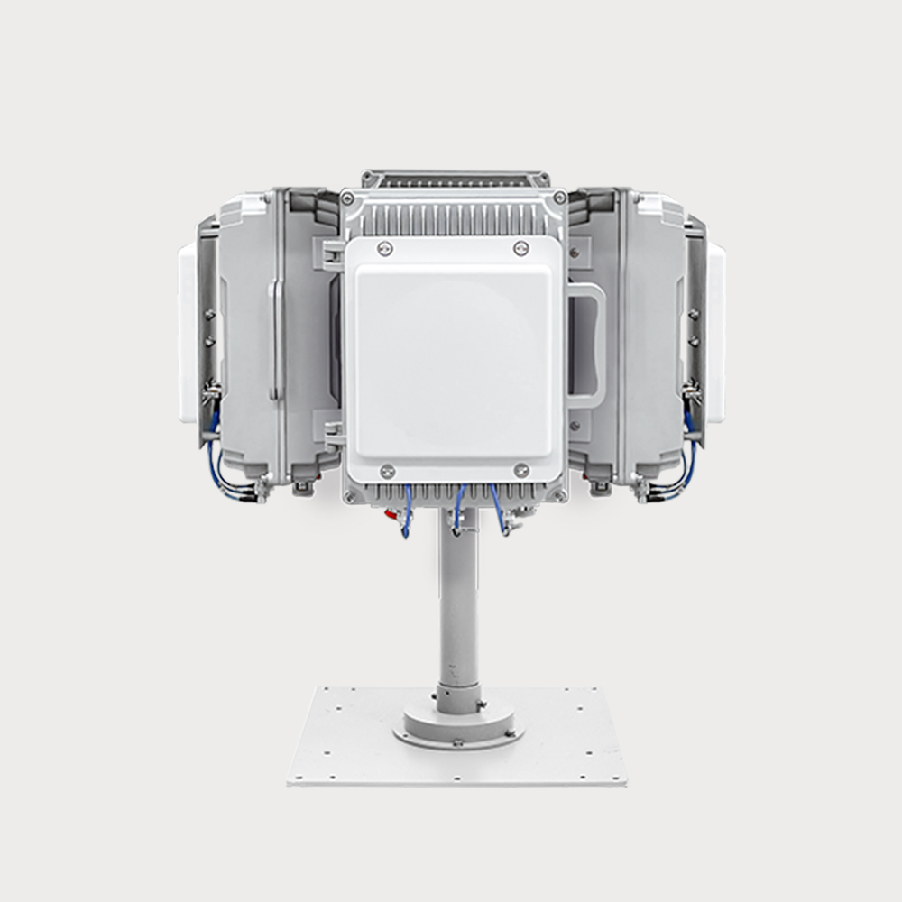
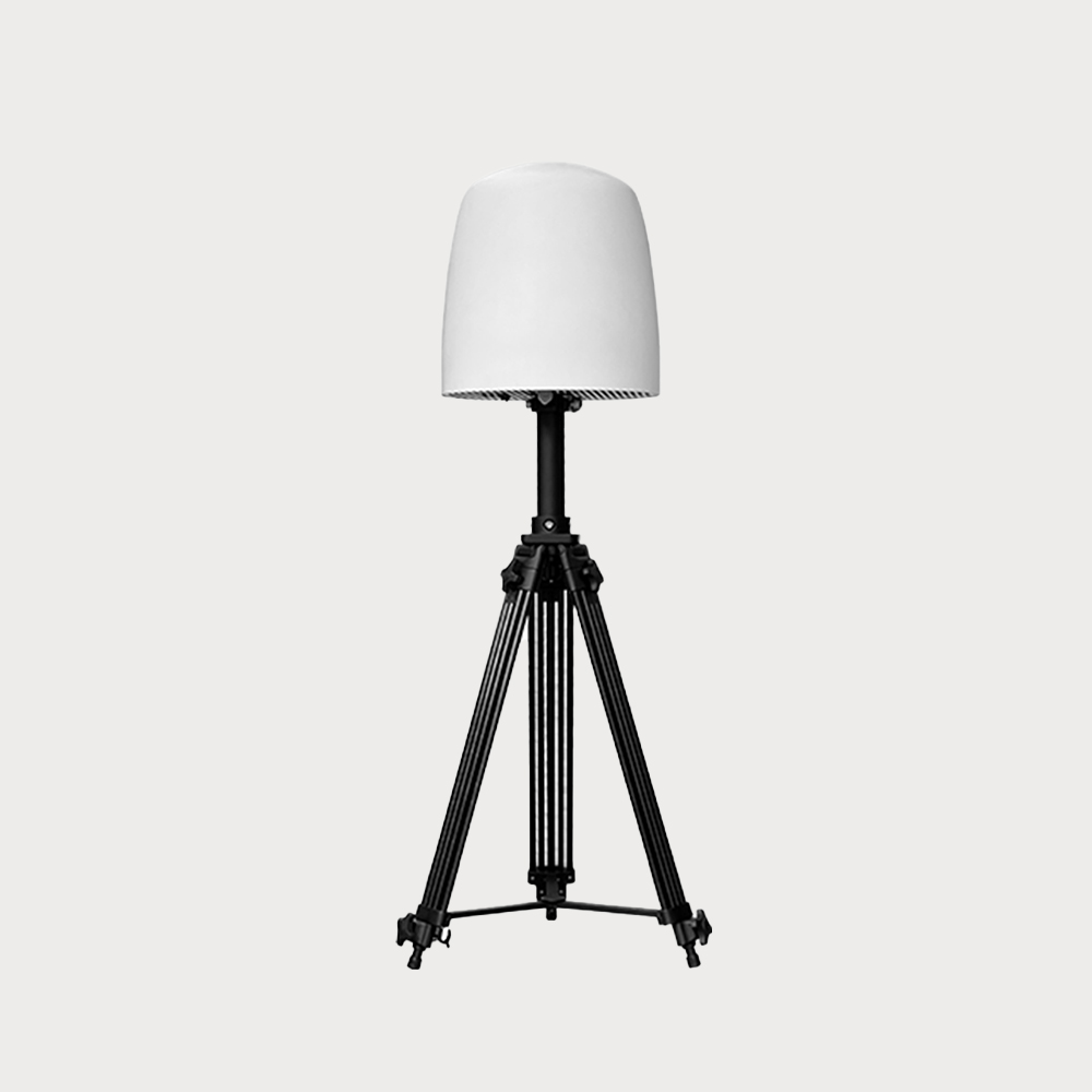
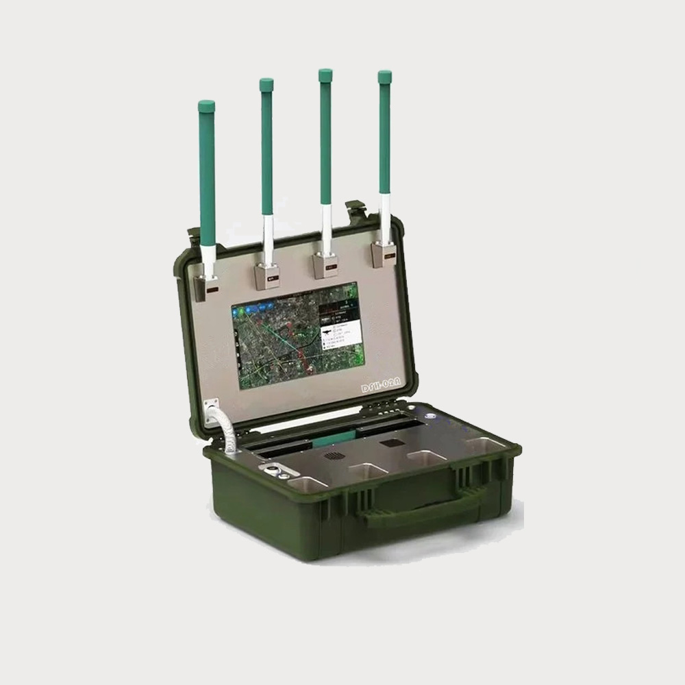
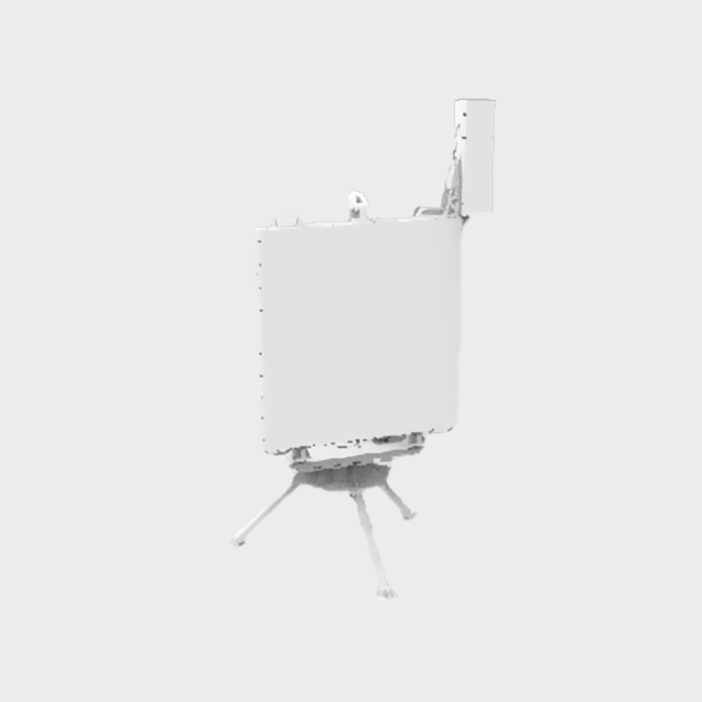
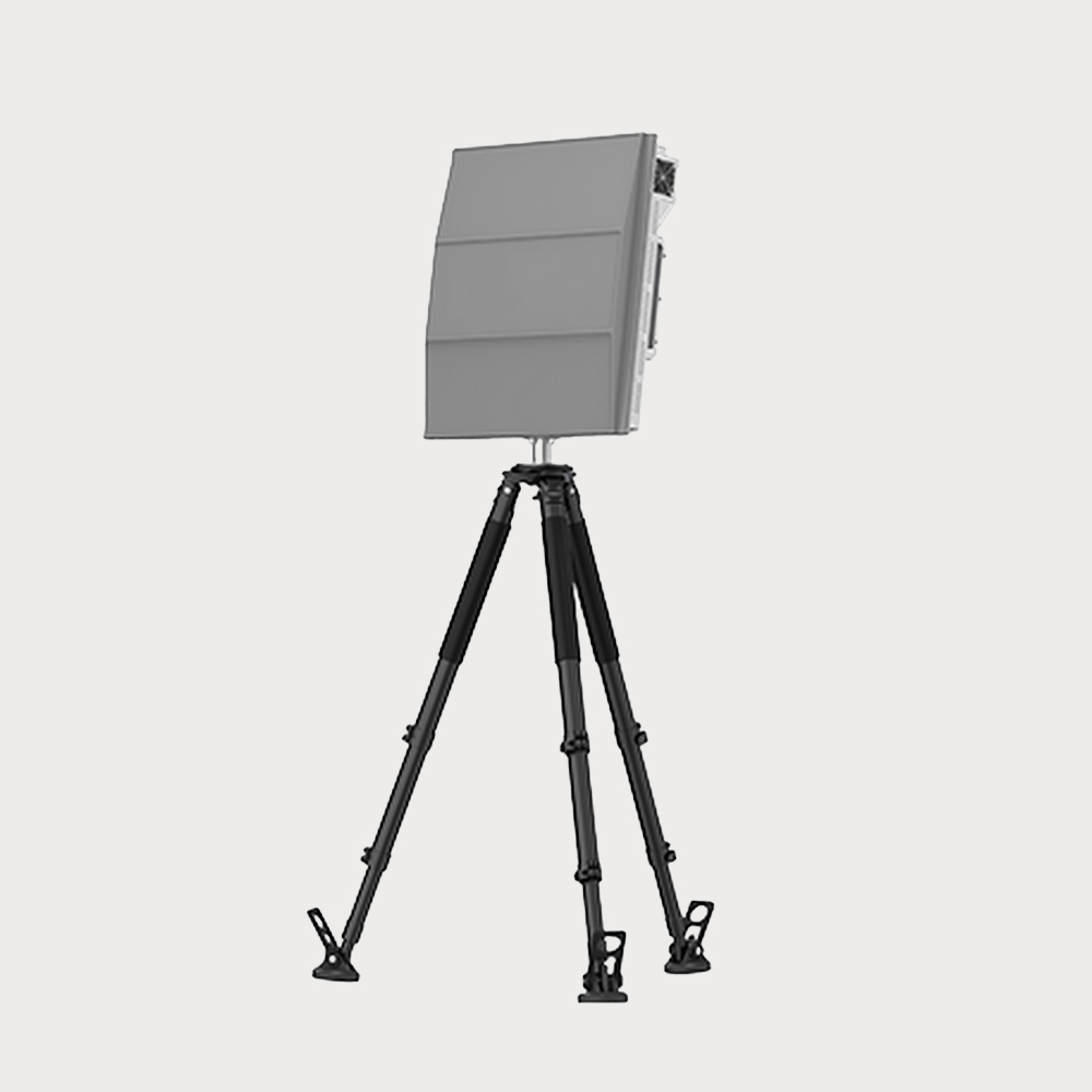
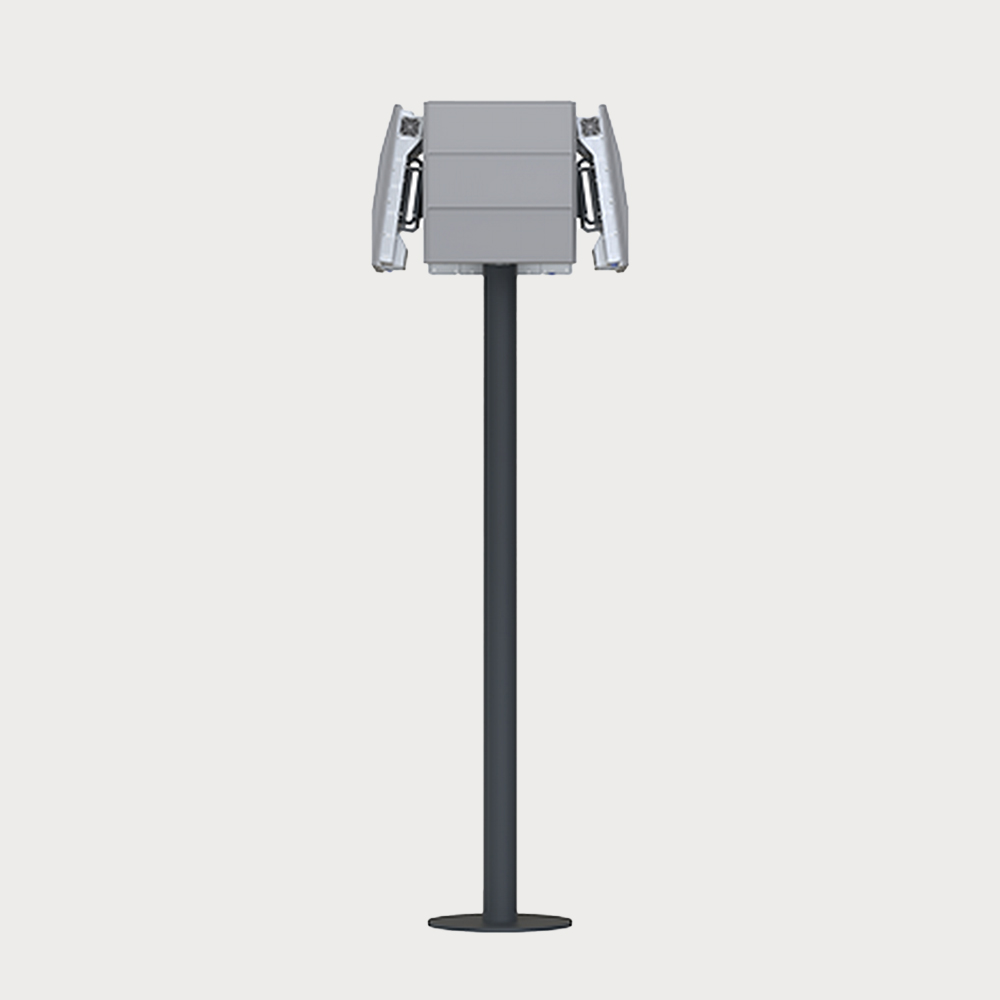
  • The RF scan 3D security radar adopts 3D scanning technology, aiming at the three-coordinate three-dimensional space surveillance of low-altitude, ground targets, all-round and high-elevation coverage, and is mainly responsible for the real-time reconnaissance of aircraft, ground personnel, vehicles and other targets in the surrounding area, finds and tracks the target, and output or report the target information to the specified user. The radar supports three erection modes: fixed, vehicle-mounted and portable, and is flexibly suitable for various low-altitude and ground security application scenarios.
  • $ Inquiry
  • 0 in Stock NowJR-HN32
  • GROUP

    SKU

  • QUANTITY

  • Contact Online

Frequency Band

Ku-band

Identify Target

People, vehicles, drones

Target Capacity

≥200

Recognition Speed

0.1m/s-50m/s

Detection Distance

2000m(consumer drone)、5000m(human)、7500m(small vehicle)

You May Be Intersted
Accurately transmit the azimuth angle and field of view angle of the target to achieve accurate positioning of moving targets such as drones, vehicles, and ships.

Integrated intelligent detection, tracking, early warning and alarm functions laser fill light intelligent identification of optoelectronics

Laser light intelligent identification photoelectric has 7*24h monitoring capabilities, which can carry out fully automatic zooming, focusing and optical fog transmission in any weather conditions. It can recognize more than 80 types of targets, such as people, vehicles, ships, etc., and provide accurate target detection and recognition. It integrates intelligent detection, tracking, alerting, and alarming for zoom close-ups and captures of visible light images. Its design supports a wide range of monitoring from 0-360° horizontally and ±90° vertically, making it suitable for close-range target detection and tracking. The system can accurately transmit the azimuth angle and field of view angle of the target, and realize the accurate positioning of moving targets such as drones, vehicles, and ships.

Inquiry
Low-power detection radar designed for "low, slow, small" targets for long-range detection of drones and vehicles in sensitive airspace

It has strong wave suppression capabilities, allowing it to detect and track low-altitude UAV targets in environments with strong clutter.

The JR1153 radar is a low-power detection radar specifically designed for "low, slow, small" targets, used for long-distance detection of drones and vehicles in sensitive airspace. It provides accurate three-dimensional position information of the target, achieving 360° full coverage of the regulated area.

Inquiry
Hacking into the "Black Fly" UAV navigation system, so as to achieve interception control of UAVs that require flight control using the navigation system, so that they cannot fly into protected areas

Deceptive interference is carried out on the satellite navigation coordinate information received by the UAV using satellite navigation and positioning, and the no-fly zone projection or area denial function is realized.

By radiating low-power regenerative navigation satellite signals (power no more than 10dBm), the "black fly" UAV navigation system is invaded, so as to achieve the interception and control of the UAV that needs to use the navigation system for flight control, so that it cannot fly into the protected area and ensure the low-altitude safety of the area. The equipment is designed with portable pull-rod box, which can be flexibly deployed in key areas of the field.

Inquiry
The optoelectronic tracking system completes the initial alignment of the target according to the target position information provided by the search system, and then searches for the target near the initial alignment area

It is composed of a tracking turntable and a photoelectric chamber, which is equipped with an uncooled infrared focal plane detector, a high-definition visible light camera and an image processing board

The infrared thermal imaging optoelectronic equipment is composed of a tracking turntable and a photoelectric chamber, which is equipped with an uncooled infrared focal plane detector, a high-definition visible light camera and an image processing board. The photoelectric tracking system completes the initial alignment of the target according to the target position information provided by the search system, and then searches for the target near the initial alignment area, and the suspicious target can be confirmed by automatic identification or manual designation in the search process, and then turns into the target automatic tracking working mode, so that the photoelectric sensor boresight axis and the radio frequency interference antenna installed on the tracking turntable can be aimed at the target in real time.

Inquiry
All-weather, All-round Composite Passive Positioning Technology  High Design MaturityHigh Strong Environmental Learning Ability

The equipment is based on AOA+TDOA composite positioning technology, and has the functions of detection and early warning, model recognition, positioning tracking and trajectory playback of UAVs inside and outside the multi-station range

The full-frequency detection equipment is mainly composed of an array antenna, a radio frequency circuit, a multi-channel synchronous receiver, a GNSS positioning module, etc. The equipment is based on AOA+TDOA composite positioning technology, and has functions such as detection and early warning, model identification, positioning tracking and trajectory playback of drone within and outside the range of multiple stations. Any number of detection devices can be freely expanded according to the scope of the monitoring area.

$3340
The drone navigation deception system invades the "black flying" drone navigation system by radiating low-power regenerative navigation satellite signals

Effective for most brands of drones, capable of achieving 360 ° all-round defense

The drone navigation deception system invades the "black flying" drone navigation system by radiating low-power regenerative navigation satellite signals, thereby achieving interception and control of drones that need to use navigation systems for flight control, preventing them from flying into protected areas and ensuring low altitude safety in the area.

Inquiry
Disabling the drone's satellite navigation, wireless remote control, and wireless video transmission links forces the drone to hover in place, land, or return to the original route

Full spectrum jamming, covering 20MHz-6GHz, with customizable frequency bands

The omnidirectional jamming device uses an omnidirectional antenna array to block and interfere with the reception and processing of drone signals, such as video transmission, remote control, and navigation, within a 360° range. This achieves countermeasures like forced return, forced landing, and repelling, allowing for rapid and effective handling of suspicious drones.

Inquiry
Disabling the drone's satellite navigation, wireless remote control, and wireless video transmission links forces the drone to hover in place, land, or return to the original route. Compared to omnidirectional jamming, the strike is accurate

Compared to omnidirectional interference, the targeting is more precise, the impact on the surrounding environment is minimal, and the reliability is higher.

The device is mainly used for signal interference of UAV, and can be combined with the detection equipment of UAV to form an intelligent linkage defense system.

$97110
Shop by Categories